Showing posts with label fort. Show all posts

Friday 29 July 2022

My visit to Kharpocho Fort, Skardu in 2003

My father, an avid traveler, explored the remote regions of northern Pakistan in the early 1980s. It is from him that I inherited my love for mountains and nature. In the summer of 2003, during our vacation, we embarked on a memorable trip to Gilgit Baltistan. After spending a few days in Gilgit, where we visited the Kargah Nullah Buddhist site, we continued our journey to Skardu city. One of the highlights of our visit was the Kharpocho Fort, which required a bit of hiking to reach. Perched atop a hill, the fort offered a breathtaking view of the entire cityscape. Accompanied by three friends from university, we carefully captured each moment on our film roll camera, cherishing the experience.


Known as the "King of Forts," this magnificent structure is situated in Skardu city, within the Gilgit-Baltistan region of Pakistan. Renowned Australian mountaineer and filmmaker, Greg Child, described the fort as being strategically positioned above the confluence of rivers, providing an awe-inspiring vista of the Rock of Skardu.


Originally constructed by King Ali Sher Khan Anchan in the late sixteenth century, the fort's significance attracted the attention of General Zorawar Singh, a member of the Dogra Rajput clan serving under Maharaja Gulab Singh. Recognizing its strategic location, General Zorawar Singh occupied the fort as part of his military campaigns to incorporate the Baltistan region into the princely state of Jammu and Kashmir. However, in 1857, under the guidance of Ranbir Singh, the fort was completely demolished. Even Mughal emperor Aurangzeb had made unsuccessful attempts to capture the fort.


During the First Kashmir War in 1947, the fort played a crucial role. The Jammu and Kashmir State Forces, commanded by Lieutenant Colonel Sher Jung Thapa, were stationed within its walls. The fort came under siege by the Gilgit Scouts and rebel troops aligned with the Pakistan Army. On February 11, 1948, a fierce battle ensued between the Pakistani forces and the Skardu garrison stationed in the fort. After a six-hour confrontation, the attackers were forced to retreat. However, they returned on February 14, continuing their assault on the fort with intermittent fire. The siege persisted for over six months, and due to dwindling supplies of ammunition and rations, the Kashmiri forces were eventually compelled to leave the fort in small groups on August 13, 1948. Tragically, on August 14, the fort fell to the invaders, with most of the remaining defenders reportedly losing their lives, except for Colonel Thapa and his Sikh orderly, who were taken as prisoners. As a result, Skardu became a part of Pakistan-controlled Kashmir, later renamed Gilgit-Baltistan.


Sunday 2 May 2021

Sadhu Bella (2020)

(Pictorial Blog)
Date of Visit 23rd February 2020


It was established in 1823 by Swami Brakhandi Maharaja and is located in Sukkur on the Indus River. Swami Brakhandi Maharaj migrated from Nepal and settled in this part of Sindh. It is believed that he spent almost 40 years worshiping the goddess of food Mata Anporna, who blessed the land with abundant food


Tuesday 21 July 2020

Remains of Bakhar/Bukkur Fort (Island), Sukkur (2020)


23 February 2020
All photos are owned 


Bakhar During our trip to Sukkur, we planned to visit Bakhar Fort. Unfortunately, we were unable to obtain permission to visit this historical site, as it is located on a small island named Bakhar in the Indus River, between the towns of Rohri and Sukkur. Currently, the premises of the fort are occupied by an army school, and access is restricted to the general public.

Despite being unable to enter the fort, we managed to capture a few pictures of the site from the opposite bank of the Sindh River at Satyan Jo Aastan, known as the "Seven Sister Graves."

The island itself has an irregular shape, approximately 2 furlongs broad in the North-South direction and 4 furlongs long in the East-West direction. The entire island is encompassed by the fortification wall, which runs along the outer periphery and touches the waters of the Indus. The western portion of the island is inhabited and features barracks and a parade ground, but it lacks any prominent monuments except for a shrine and a ruined mosque. However, the presence of brick bats, pottery shards, and heaps of earth scattered throughout the area suggests that this part of the island once contained numerous buildings. The fortification wall, which used to encircle the entire island, has mostly disappeared, except for a few remnants here and there, particularly in the southern and northwestern sides. The wall was constructed using burnt brick tiles, primarily measuring 12"x12"x21½" in size, although various sizes of bricks were likely used for repair purposes. Several bastions, with semi-circular and elliptical shapes, still stand, alongside gateways of different sizes, now partially obscured by rubble. The fortification wall is approximately 5 feet thick, but in some places, it reduces to only 2 feet in thickness, while its height ranges from 10 to 10 feet.

The fort is divided into two equal parts by a railway line. The western part of the fort contains only two buildings—a modern shrine or tomb and a mosque constructed with burnt bricks and mud. The eastern part, however, only exhibits scattered foundations of walls.

Bakhar Fort, also known as Bakhar (meaning "Dawn") as named by Sayyid Muhammad Al-Makki in the seventh century of the Hijri calendar, is situated on a limestone rock island. The island is oval in shape, measuring approximately 800 yards long by 300 yards wide, and stands at a height of about 25 feet. According to historical records from 1912, the Superintendent of Land Records and Registration in Sindh stated that the area of Bukkur Island was 255,292 square yards, equivalent to 49 acres (20 hectares). Presently, Bukkur Island is occupied by an Army public school and the tomb of Sayyid Sadruddin, the son of Sayyid Muhammad Al-Makki.

The fortress of Bakhur was constructed using brick on a low rocky island made of flint, located 400 yards from the left bank of the Indus and slightly less distance from the eastern side of the river. Its walls were fortified with loopholes and flanking towers that sloped towards the water's edge, with a maximum height of twenty feet. The fortification featured a gateway on each side, facing Roree and Sukkur, as well as two smaller wickets. The interior of the fort was densely populated with houses and mosques, some of which extended above the walls, including parts of the rock itself. The fort had an approximately oval shape, measuring 800 yards in length and 300 yards in breadth. Although the rock had been pared and scraped in certain areas, Bukkur Fort derived its strength not from its structures, but from its strategic position

In 622 H. (1225 A.D.), Shums-ud-deen led an army to Oochch with the intention of overthrowing Nasir-ud-deen, who had entrenched himself at Bukkur. During this campaign, Shums-ud-deen detached Nizam-ul-Moolk to Bukkur, but Nasir-ud-deen attempted to escape by boat, which tragically capsized in a storm, resulting in his drowning.

During the First Anglo-Afghan War in 1839, the fort was armed with a garrison of 100 men from the Khyr poor Ameer and fifteen pieces of artillery. The fort's walls enclosed the entire island, except for a small date grove on the northern side, which provided a potential landing point from the right. The fort could be captured through escalation or breached from the riverbank.


Sunday 19 January 2020

The Never told Story of Tulajha Fort (2018)

All Research and text used in this blog  is own 
All pictures are own
Date of Visit of Tulajha December 23, 2018
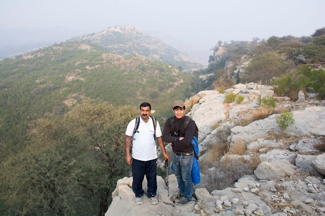
At Tulajha


The Never told Story of Tulajha Fort

Salt range is series of hills and low mountains between the valleys of the Indus and Jhelum rivers, located in the northern part of the Punjab region of Pakistan.

Samarkand and Tulajha are the names of two ancient forts that situated at different locations in Salt Range. The one common thing in both of these forts is that both attributes to Jalaluddin Khwarazm.
Following the defeat of his father, Ala ad-Din Muhammad II by Genghis Khan in 1220, Jalaluddin Khwarazm came to the power. Jalal ad-Din retreated with the remaining Khwarazm forces, while pursued by a Mongol army and at the battle of Parwan, north of Kabul, defeated the Mongols. Due to the Mongol invasion, the sacking of Samarkand and being deserted by his Afghan allies, Jalal ad-Din was forced to flee to India. At the Indus River, however, the Mongols caught up with him and slaughtered his forces, along with thousands of refugees, at the Battle of Indus.
Famous travel writer Salman Rasheed mention in his article that,

in February 1221, Jalaluddin Khwarazm on the run from the Mongols passed through this area. Here, he befriended the local chieftain Rai Sangin of the Khokhars. With the Mongols breathing down on the man, I imagine he would have asked his host if there was a secret sanctuary to shelter from his tormentors.”

Jalaluddin Khwarazm was and along his last left troops jumped into mighty Indus near the place close to present village of Sojhanda Bata in Kohat. Mongols troops were also after them; Jalaluddin needed to find very fast some safe shelter for his fatigued army and himself. He reached to the foots of Salt range to the village which presently named Maira Aemah. Where, he pleaded for the help in front of Khokhar chieftain of that time Rai Sangin.

Rai Sangin might have feel pity on Khwarazam sultan and taken him to the fortress hidden away behind the ridges, which Jalaluddin Khwarazm named Samarqand in memory of his hometown. Samarqand was small settlement could not accommodate a large army and more a hideout place than a proper fort. The remaining troops were hiding on the bed of less active Ghambir river. Then the monsoon season arrived, water level started to rise in Ghambir River. Troops shifted to slippery and unsafe ridges of rugged mountains.

At Samarkand fort


Meanwhile to further strengthening relations among two chiefs; Rai Sangin the Khokhar chieftain married his daughter with Jalaluddin Khwarazm.

Rai Sangin gave one more favor to Jalaluddin that was shifting him and his troops to better place of Tulaja.

Tulaja is amazing place from the defence point of view a natural fortress, a large plain roughly of 19.2 acres and 1.46 Km periphery length located on top of   mountains bounded by sharp tall cliffs on all four sides. The view of whole valley is visible from the top of the Tulaja. On this plain debris and blocks of hundreds of houses, defence wall and other structures present. One of the most interesting structures found there was a square tank also a edifice that looks close to prayer hall.

There is only one way of entrance the fort and that is also through a vertical shaft like cave. It is said that this entrance was also at night with stone in old times.

Jalaluddin Khwarazm found an ideal shelter and said that he constructed a temporary residence at Tulaja. The residence consists of roughly three hundred houses, water supply and water tank. All construction done in stone masonry. There was no mortar used in this construction, this style basically found in Buddhist construction.

Few questions came to my mind after visiting Tulaja. Jalaluddin spent three year of exile life in Indian sub-continent and that tenure mostly passes while living in Delhi, Uch and Sindh.  His period of living in Samarqand and Tuljah could not be more than few months. How this large settlement constructed in such less time. Second question, that came to my mind was that, is there any other construction in salt range built on similar model.
I am travelling to different historical locations of the Salt Range from the last twenty five years; I had also visited the site of Samarkand Fort. It is located on hill top and required hiking of roughly two and half hour from Maira Aemah village. There were ruins and debris of an old fort everywhere and nothing is left except a defensive wall and bastion. There might be possibility that the Mongol troops who were after the Jalaluddin Khwarazm reached to the fort site. Jalaluddin army got an early alert and due to hilly terrain find the time to escape and in retaliation Mongol army destroyed the whole fort and turned into ruins. The stone masonry of defensive wall is somehow similar to masonry pattern found at Tulajha.

Samarkand Fort

At Ruins of Samarkand Fort


Earlier, I also visited another site in Salt Range that is the Amb Temple and its surrounding fort. It was constructed in Hindu Shahi period. I have seen similar block construction in defensive wall of Amb fort to what I have seen at Tulajha as well.

Amb temple and Fort 

Salt range was under Hindu Shahi Empire from (879-1026) AD and most likely Tuljah constructed in same period.

Association with Hindu Deity

Tulaja Meaning: Indian goddess of mercy, kundalini shakti and slayer of evil. That name must have been given to this town and fort in Hindu Shahi period but nothing can say with surety.

Settlements outside the Fort

Outside the fort in adjacent areas similar ruins and settlement found. It is believed that the less ranked army and minor citizen used to live there. So this also gives a new insight that Tulajha was sub-empire, a small town in Hindu Shahi period. The settlements outside the fort have different name they are called Tulaji by local peoples.

Buddhist Graves

One can also find large number of Buddhist graves in the valley, so the area is known to humans from prehistoric time.

The 5000 Year’s Old Myth

Few people made video blogs and highlighting that Tuljah site could be as old as 5000 years. There are no such historical findings that can prove these claims. However Tulajha located at one of the best site from the defensive point of views and as I said above Tulajha is natural fortress and an ideal place of shelter for pre-historic men.

How to Reach Tuljah

A metal road connects Khushab and Nowshera, on this road roughly travelling thirty three kilometer, you will find a sign board pointing towards right Baba Kacchayawala Shrine. The shrine is located fourty five minutes from that signboard. From there Tuljah fort is roughly and hour distance of moderate level of hiking.

** Specially wanted to thanks my friend Adnan Alam Awan from Soon Valley, who arranged a special tour for me to visit Tuljah.
Also wanted to thanks my friends Shiraz, Irfan Afzal and my brother Salman Baig who came along with me from Lahore.


At Tulajha